
Using your Smartphone/Tablet for High-Precision GPS Data Collection in Forestry and Natural Resources
Agenda

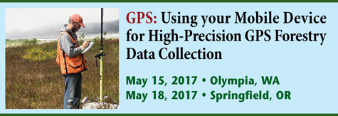
Location: Olympia, WA or Springfield, OR
Start Date: May 15, 2017 or May 18, 2017
8:30 Introduction and Overview
8:45 BYOD – The Future of Field Data Collection
- What is BYOD (Bring Your Own Device)?
- Why BYOD makes sense.
- When BYOD doesn’t make sense.
9:30 GPS/GNSS receivers: Basic operation and technology trends
- How does GPS work?
- How accurate is GPS?
- Different categories and capabilities of GPS receivers. Recreational vs. Professional
- GPS Advancements: What can you expect in the next couple of years
10:30 Break
10:45 A look at BYOD hardware and software:
- iOS, Android, Windows smartphones, and tablets.
- Screen readability, GPS accuracy, ruggedness, expandability, and flexibility.
- Open source (free) vs. paid. Esri, tMap, Avenza, GIS Cloud, etc.
- Cloud vs. on-device software. To download or not to download?
- What combination works best for you?
12:00 Lunch
1:00 GPS mapping fundamentals and troubleshooting
- Why doesn’t my data line up?
- Map projections and datums.
- GIS data collection structure. Points, lines and polygons.
- Field data collection forms.
- Linking photos to data.
2:30 Break
2:45 Using background map data. Sources and cost.
- Imagery (aerial/satellite/UAV photos).
- Vector (roads, parcels, contours, etc.).
- Sources of free and paid data.
3:15 Wrap up and Q&A
4:00 Adjourn
About the Instructor
Eric Gakstatter has been involved with GPS for more than 25 years as a product manager, consultant and power user of GNSS technology. He has used GNSS receivers on six continents.
Since 2006, Eric has been the high-precision GNSS editor for GPS World magazine, writing over 100 technical articles and speaking at numerous conferences in North America, Europe, Africa and Australia. Eric’s consulting firm, Discovery Management Group <www.gps-mapping.com>, is located in a suburb of Portland, Oregon, where he operates a GNSS lab to test GNSS receivers, mobile devices and GPS/GIS data collection workflows.
Conference Photos

Click here to learn more about the UAV: Do-It-Yourself Accurate Drone Mapping in Natural Resources workshop and agenda.
About the Conference
GPS: Using your Smartphone/Tablet for High-Precision GPS Data Collection in Forestry and Natural Resources
You don’t need a dedicated handheld GPS receiver any longer
May 15, 2017 Hotel RL (Red Lion), Olympia, WA or May 18, 2017, Holiday Inn Eugene/Springfield, Springfield, OR (Same agenda at each location)
The workshop will explore the growing trend of using smartphones and tablets in the field as GPS/GIS data collection devices (BYOD – Bring Your Own Device).
Smartphones and tablets are becoming standard field tools for voice communications, texting, email and internet access. They are also a natural fit as GPS data collection devices given their beautiful screens and storage capacity. Carrying a specialized “GPS handheld” is no longer necessary to collect high-accuracy, feature-rich data.
How accurate is the GPS chip inside your iPad? How can you get sub-meter or centimeter accuracy using your iPad, iPhone or Android device? Which software should you use on your smartphone/tablet to collect GPS/GIS data.
The workshop will also discuss the basic concepts of how GPS works and how GPS and GNSS will change significantly over the next few years. Join a lively discussion about how GPS/GNSS will change more in the next five years than it has in the last 15 years.
Attendees are encouraged to bring their own mobile devices, including legacy GPS handhelds, for an interactive workshop.