
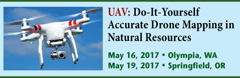
Do-It-Yourself Accurate Drone Mapping in Natural Resources
Agenda

Location: Olympia, WA or Springfield, OR
Start Date: May 16, 2017 or May 19, 2017
8:30 Introduction and Overview
8:45 Drone Rules
- How to obtain a drone pilot certificate.
- 20 hours of on-line study. Common test questions. Local test centers.
- Drone flying rules. Where can you fly and not fly?
- Flying by yourself, flying in the woods and around people.
- Hobby vs. business flying.
- The intent, not the drone, is the differentiator.
10:30 Break
11:00 Drone Technology: Capabilities, cost and pros/cons
- Airframes
- Rotorcraft, fixed-wing, hybrid.
- Flight controller (tablet/smartphone vs. proprietary).
- Airframe pros/cons.
- Batteries.
- Operating differences.
12:00 Lunch
1:00 Drone Technology (continued)
- Mission planning software
- Third-party vs. manufacturer-supplied.
- iOS vs. Android vs. Windows.
- Sensors
- RGB cameras (photogrammetry, Phodar point clouds).
- Lidar, thermal, NDVI (Normalized Difference Vegetation Index).
- Image processing software
- Matching images effectively and accurately.
- Using ground control points.
- Cloud processing vs. Stand-alone processing.
- Producing orthophotos, DEM (Digital Elevation Model)/DSM (Digital Surface Model), contours, volumes and 3D models.
- Integrating into GIS (ESRI) systems.
2:30 Break
2:45 The Possibilities. What’s Possible with a $1,500 UAV?
- Orthophoto example.
- Elevation contour example.
- 3D model example.
- DEM/DSM example.
- Volume example.
3:30 Wrap up and Q&A
4:00 Adjourn
About the Instructor
Eric Gakstatter has been involved with UAVs since 2012. He holds an FAA Private Pilot certificate and an FAA 333 Exemption to fly UAVs for commercial operations. He’s tested UAVs from a wide variety of manufacturers using several different sensors.
He has presented at many conferences and written many articles for Geospatial Solutions on the value of using inexpensive UAVs to produce high-accuracy data.
Eric’s consulting firm, Discovery Management Group <www.gps-mapping.com>, is located in a suburb of Portland, Oregon, where he tests various UAVs and processes UAV imagery using specialized software and high-performance computers.
Conference Photos

Click here to learn more about the GPS: Using your Mobile Device for High-Precision GPS Forestry Data Collection workshop and agenda.
About the Conference
UAV: Do-It-Yourself Accurate Drone Mapping in Natural Resources
May 16, 2017 Hotel RL (Red Lion), Olympia, WA or May 19, 2017, Holiday Inn Eugene/Springfield, Springfield, OR (Same agenda at each location)
You no longer need a traditional FAA Pilot license or a $50,000 drone to start using UAVs for mapping and inspection. The FAA rules changed last summer so it’s much easier to start flying now. Consumer drones are getting better, faster, less expensive and easier to fly.
The workshop will explore: 1. The current FAA rules for flying drones and what it takes to obtain a drone pilot certificate. 2. Discussion about different types of drones, costs, and capabilities. 3. Examples of products and data you can produce with an inexpensive drone.
The workshop will discuss the basic concept of how UAVs work and how they will change over the next few years. Join a lively discussion on collecting data with drones. You can now put a drone in your pickup along with the rain gear.
Attendees are encouraged to bring their own drones for an interactive discussion.
Static display of drones will be available at the workshop.